IoT and Big Data in Geotechnical Construction: Connecting Drill Rigs to the Cloud

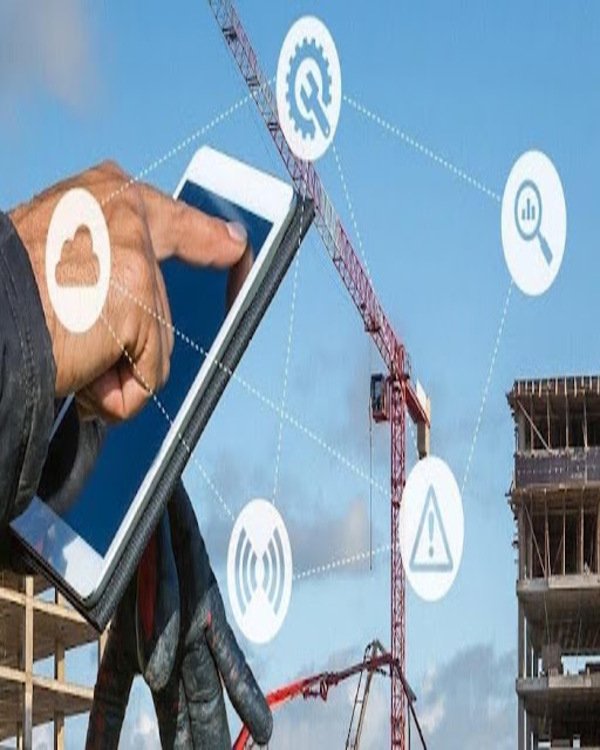
Today, it’s almost impossible to escape the buzz surrounding technologies and concepts like Big Data, Internet of Things (IoT), machine learning (ML), and artificial intelligence (AI). These emerging technologies are already impacting many aspects of daily life, from “Hey Siri, what’s on my calendar today?” to “Alexa, turn on the kitchen lights.” We live in a world where the generation of information and data is growing exponentially. However, geotechnical engineers often take pride in working “on the ground,” and for many, these new technological concepts seem out of place or impractical. Yet, there is currently an explosion of innovations in the geotechnical construction field tied to the development of Big Data, ML, and IoT.

A Data Influx

Geotechnical engineers have traditionally taken a 3D world and simplified it to 1D or 2D. They report on complex geology through drilled logs or 2D sections in drawings. Drilling operators manually record every hole in their field books. This approach used to be driven by two limitations: there was very little data available for any given project, perhaps only a few boreholes, and the tools at our disposal for analysis also had limited capabilities. Fortunately, this situation is rapidly improving. In the field of geotechnical construction, the combination of advancements in computer power, onboard sensors in drilling rigs, cloud communication capabilities, and the increasing demand for quality control has made it possible and necessary to visualize, compare, and remotely analyze, in real time, the vast amount of data being generated. “Connected sites” are now a reality, and the data collected on-site will continue to help engineers better understand the soil, predict how it will respond to construction techniques, and apply lessons learned to future projects.

Mastering and intelligently using the large amounts of data generated in geotechnical works requires collaboration among many stakeholders:

  • Ultimately, owners pay for the data generated by geotechnical engineers and contractors on their projects, but they need to allow engineers to aggregate this data into large databases. 
  • Geotechnical engineers are generating soil data from drilling and laboratory tests. It is still common to receive PDFs or even scanned copies of geotechnical reports, but standardization and coding are necessary steps in our journey toward digitalization. Standard digital formats for geotechnical exploration, such as AGS (UK) and DIGGS, will provide a platform to aggregate and share spatially referenced soil information. DIGGS is an open standard that simplifies the exchange of geotechnical data. It is currently expanding to other sources, such as load test data, instrumentation monitoring, and geo-environmental data. Using a standard for geotechnical data will ensure that information can be shared among stakeholders and from one job to another without the constraints of proprietary software. 
  • Geotechnical contractors can collect data from their equipment to create their own database of information. 

Most equipment manufacturers now record and centralize the operational parameters of their machinery and are beginning to integrate monitoring data into the instrumentation systems that contractors install on their machines. There is still a long way to go before an open-source standard for collecting equipment data exists, but significant progress has been made in recent years.

How are Big Data, ML, AI, and IoT being integrated practically into our job sites today? How far are we from a truly smart and connected site? What does the future look like?

The Future Job Sites

The first step in the digitalization of geotechnical production on a job site is real-time data collection. Thanks to the rapid development of onboard computers installed on drilling platforms, data is increasingly easy to collect and share. The future belongs to those who can efficiently collect data in the field using sensors and monitoring systems, examine this data with existing geotechnical soil and test databases, and analyze this information using the predictive power behind ML and AI. Then, this information can be fed back to the equipment to optimize production and operational parameters. Once this feedback loop is complete, the response of equipment to soil conditions can be optimized to modify and adapt operating procedures to ensure that the performance of the installed system meets the design intent. All of this could occur instantly in real-time during drilling. It’s not a big leap to imagine that autonomous drilling rigs in the future will be as ubiquitous as autonomous trucks in most current mining operations. Fully autonomous drilling rigs are still a dream, but significant advancements have been made through R&D and the integration of new technologies in the geoconstruction field. Three recent examples illustrate some of the key advancements and give a glimpse into the future.

Smart Grout

Grouting projects typically follow a similar process: design, preparation, execution, and reporting for quality control. Nicholson Construction, which employs two of the authors of this article, is an example of a contractor that has implemented software and hardware tools to guide and assist engineers and equipment operators in ensuring an optimized and high-quality final product. Nicholson uses a proprietary solution called Grout I.T., as shown in the workflow in Figure 1.

In the design phase, each injection site is modeled in 3D according to the design’s specifics (location, inclination, orientation, length, etc.). This approach allows the generation of a 3D grouting plan that incorporates all key design components. This can be communicated to the field staff in an easy-to-visualize manner.

During the preparation phase, the project is analyzed and divided into different areas with similar characteristics, based on the available geotechnical information and known site limitations. This work sequence is stored in the Grout I.T. database and is used to plan the work. Each grout hole and its design parameters are available to the project team when drilling begins.

In the execution phase, the instructions defined in the previous phase are implemented and monitored in real-time. For example, Grout I.T. software is connected to the pump to automatically control grout volume, flow rate, and other parameters in real-time to react and anticipate the soil’s response. Field engineers monitor and visualize progress through a monitoring station located in the site trailer. The collected data can be adapted to the project: for the Boone Dam repair in karst conditions in Tennessee (Figure 2), for example, Grout I.T. was updated to monitor parameters such as grout loss, grout composition, drilling fluids, and water tests. The engineer overseeing the operation can quickly and easily react and modify parameters to adapt to changing ground conditions without delay.

While it still requires engineer intervention, Grout I.T. is an important step toward integrating equipment responses and analyzing/modifying installation parameters in real-time to ensure optimal quality of the final product. The next step for full automation will be integrating ML components.

Once each injection point is completed, the reporting module can generate individual reports or 3D visualizations by area, as well as analyze productivity to provide valuable insights to engineering teams, operations teams, and estimators. Systems like Grout I.T. have the potential to bring grouting closer to a fully automated process. It’s important to remember that, just as robotic surgery didn’t replace surgeons, the goal is not to eliminate human decision-making from the process. Good engineering judgment remains critical. Machine learning or AI won’t replace good engineering, but they will reduce the risk of errors, improve understanding and response time to changing soil conditions, enhance productivity, reduce safety risks, and minimize rework, ultimately resulting in cost and time savings and a better-quality final product overall.

Improving Project Efficiency

Big Data refers to datasets that are too large or complex to be analyzed using traditional methods and software. With the systematic installation of a wide range of sensors and data collection systems on equipment, understanding Big Data has become one of the key challenges for geotechnical construction sites. The challenges include the volume of data, the speed of analysis, integrating different data sources, accuracy, and providing added value.

The Big Data input is represented by the multiple data sources currently available, such as machine sensors, geotechnical databases, design parameters, and test databases. There are a variety of possible output mechanisms: direct visualization, automatic reports, and integration with existing systems and databases. The system can help multiple departments within an organization, from assisting the operator in guiding the equipment, to the quality engineer generating reports for the client or the estimator using a database of previous references to estimate productivity for the next project.

A proof of concept for Big Data was a large transport project in Hong Kong. Due to its exceptional size (over 60,000 soil mixing panels), the project required mobilizing 16 soil mixing rigs to work 24 hours a day, 7 days a week in extended double shifts. More than 100 soil mixing panels were completed daily. Each platform and supporting equipment were autonomous and installed on a barge with its own set of onboard monitoring systems. Each system transmitted real-time production data via wireless data connections to a central server located at the site offices.

Closing the Data Loop

A similar process was implemented in a project for a large warehouse near Detroit, Michigan (Figure 3). The multi-story warehouse support required the installation of several thousand CFA piles, ranging from 14 to 24 inches in diameter. Up to four rigs were mobilized. Each platform was equipped with an onboard monitoring system wirelessly connected to a central data acquisition server. A Big Data system was used to collect and analyze data on drilling speed, pressure, concrete breakage, and many other parameters (Figure 4). Reports on construction were provided to the client, and data was added to an existing pile database to develop prediction tools for future projects.

By: By: Frederic Masse, M.ASCE, Rick Deschamps, PhD, PE, M.ASCE, Alexandre Scarwell, and Thomas Joussellin

References

  • Masse, F., Deschamps, R., Scarwell, A., & Joussellin, T. (2021). IoT and Big Data in Geotechnical Construction: Connecting Drill Rigs to the Cloud. GeoStrata Magazine Archive, 25(3), 30-35.
Scroll al inicio